Search Term Record
Metadata
Name |
Garafraxa Road |
Details |
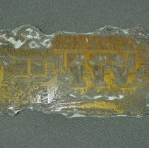
Source: Paul White (2024): https://www.history-articles.com/garafraxa-road.html Building the Garafraxa Road was an imperative necessity to connecting the Grey and Bruce region to the rest of the Upper Canadian colony. The decision to create a land route between Guelph and Georgian Bay was made by the colonial government in the 1830s. However, due to the Upper Canadian Rebellion, it was not until 1837 that the government commissioned Charles Rankin to blaze a trail for the builders of the road to follow. In order to blaze a trail, a pioneer surveyor would walk through the region looking for the best route. Once he chose the best path, the surveyor would walk along the route notching trees with his axe. The marked trees would guide the crews, who followed, where to clear the land for the road. Have you ever noticed that Highway #6 has a lot of twists and turns, when it appears that the land surrounding the road would have facilitated a much straighter route? The reason dates back to 1837. Rankin wanted the Garafraxa road to follow the highest levels of ground in order to avoid the swamps and low-lying areas where water would make the road not only difficult to build, but also treacherous to travel. Construction of the Garafraxa Road did not begin until 1841, almost four years after Rankin originally blazed the route. One of the reasons for the slow start on the road was that the government felt that Rankin's route was too long. So, they sent out another surveyor, John McDonald, to straighten out, and shorten the road. McDonald was also directed to "run a line" from just north of the present-day community of Mount Forest to the current southern limits of the city of Owen Sound. The rationale for this line would be to mark boundaries for proposed townships when settlement occurred in the region. When Rankin had surveyed the route, he had tried to avoid the area which later would be known as the "Long Swamp" or the "Forty Mile Swamp." McDonald, however, chose to blaze his route directly through the swamp. This new route was as much as two and one-half miles east of Rankin's path. Despite McDonald's efforts to shorten the route it ended up only three-quarters of a mile shorter than Rankin's original survey. In 1841 a crew began clearing the Garafraxa Road. A.M. Stephens, a future mayor of Owen Sound, was a member of that road gang. Unfortunately, it took several years before the route was cleared completely. In the ensuing 15 or more decades, surveyors and road crews have continued to straighten and widen the Garafraxa Road. The information used in this article came from many different sources including the memoirs of A.M. Stephens. Of primary importance were two local history books, Normanby Reflections; A History of Normanby Township and The History of Sullivan Township, 1850-1875. A version of this article, "Building the Garafraxa Road" originally appeared in my Local History column on January 7, 2000 in the Owen Sound Sun Times. ----------------- Wikepedia (2024): The Garafraxa Road LocationGuelph – Owen Sound Formed1837–1848 The Garafraxa Road was built to extend Brock Road north from Guelph to the new settlement of Sydenham, renamed Owen Sound in 1851, on Georgian Bay. An Order in Council was passed that called for the building of this road on April 13, 1837. Deputy Surveyor Charles Rankin was allowed to lay a line between Oakville and Sydenham. Rankin surveyed the line north of Arthur before the 1837 Upper Canada Rebellion broke out in Toronto. In 1839, John McDonald was hired to resurvey the line. He completed the survey between Guelph and Fergus that year, and to Arthur by October 1842.[17] Construction of the line between Arthur and Sydenham began at both ends in 1843.[18] The entire route was navigable by 1848. By 1861, the majority had been gravelled, and tollgates were briefly established between Fergus and Owen Sound. The entire route became part of Highway 6 in 1920.[17] ----------------------- There are a couple of thoughts as to why the "Garafraxa Road" was given its name. One idea was that "Garafraxa" was a castle in Ireland? Another historian suggested that it was a mispronunciation of the First Nations word for sassafras, which was a good remedy against poison ivy. Aother source suggested that it was from a First Nations term for "panther country", as there were large wild cats in the area at the time. The Garafraxa Road was a colonization road. Edith Marsh, in her book A HISTORY OF GREY COUNTY (1931), mentioned that the Garafraxa Road was named after Garafraxa Township, which hitherto had been the most northerly township then settled. The short form "E.G.R." on old land documents is a "East of Garafraxa Road" notation. "W.G.R." meant West of the Garafraxa Road. |


